Beautiful Hiking Trails in Connemara, Ireland

The cultural region of Connemara in West Galway is known for being one of the most beautiful natural landscapes in the entire world, never mind just Ireland. Connemara is home to some of the country’s finest walks and hiking paths, making it best explored on foot. Culture Trips rounds up 10 of the best.
Did you know – Culture Trip now does bookable, small-group trips? Pick from authentic, immersive Epic Trips, compact and action-packed Mini Trips and sparkling, expansive Sailing Trips.
Easy
The Cong and Clonbur Forest Trail

This linear nature trail passes through the Cong and Clonbur woods, the latter of which is a dedicated Special Area of Conservation, thanks to its unique variety of flora and fauna. The trail start-point can be accessed in the village of Cong, astride the Galway-Mayo border, on the grounds of the abbey that housed the last High King of Ireland. Passing across a scenic stone bridge into the woodland, the 6km (3.7-mile) forest walk begins, finishing in the Clonbur car park two-and-a-half hours later.
Claddaghduff Quay to Omey Island Walk

Omey is a beautiful tidal island situated off the coast of West Connemara, close to the village of Claddaghduff. Impassable during high tide, the signposted route along the tidal sands of Omey Strand reveals itself as the only access to the island when the sea recedes. On the island, there is plenty to discover, such as the medieval church known as Teampall Féichín, shell middens dating back to before 1,000 AD and a holy well. Make sure to check tide times before departing. This walk, around 6km (3.7 miles) in length, takes anywhere between one and two hours.
Mount Gable Walk

Binn Shléibhe, known in English as Mount Gable, is a 400-metre (1,312.3-foot) hill peak not far from the Galway-Mayo border. An easy-to-moderate climb, this hike takes about five hours to complete, beginning and finishing in the Gaeltacht village of Clonbur. At the crest, hikers will be able to relax and take in incredible views of the large lakes of Lough Corrib and Lough Mask below, as well as the surrounding mountains.
Moderate
Tully Mountain

The three-hour hike to the top of Tully Mountain on the Renvyle Peninsula is more than worth the effort. Its prime location affords spectacular views of the neighbouring coastline – including Inishbofin Island – and the Twelve Bens mountain range. As this is technically a large hill and not a mountain, the ascent isn’t too steep or difficult. However, do note that there are no marked paths to follow, so it will be essential to plan your route ahead of time.
The Errisbeg Trail

Waterproof boots are essential kit on this 7.5-kilometre (4.7-mile) looped hike around the amazing Roundstone Bog complex, beginning and ending in Roundstone village. A moderate walk up the 300-metre (984.2-foot) peak of Errisbeg hill, the trail traverses through rare bog habitat, and the summit provides dramatic vistas of the Connemara landscape below.
The Maumeen Mountain Pass

Epic mountain landscapes await on this rocky trail that links the Maam and Inagh Valleys through the Maumturk Mountains. The site of a former Celtic shrine, the Maumeen Mountain Pass is home to an ancient pilgrimage site that Saint Patrick himself is said to have visited. As well as a tiny chapel on the pass dedicated to Saint Patrick, this hiking trail, which takes three-to-four hours to complete, features spectacular views of both the coast and the inland ranges to the east.
Killary Harbour Coastal Walk

Killary Fjord is referred to as Ireland’s only true fjord, with the hills that line the inlet declining sharply into its waters. This beautiful site was listed in travel writer Steve Davey’s 2004 book, Unforgettable Places to See Before You Die. The area also has a deep significance in terms of the history of the Great Irish Famine, as evidenced by the rocky trail that served as the famine relief road at the time, as well as the ruined famine village of Foher. Beyond its history, the hike along the southern side of the fjord offers panoramic views of Mayo’s Mweelrea Mountain and the harbour itself.
Difficult
The Diamond Hill Trail

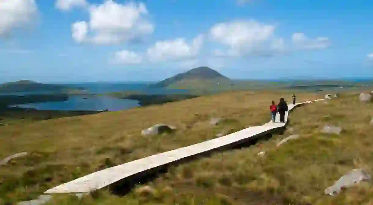
Part of the Wild Atlantic Way and surrounded by Connemara National Park, the Diamond Hill Trail is a figure-of-eight circuit made up of two loops that connect midway. The trail, which begins and ends at the National Park visitor centre, are handily accessible and well maintained. The lower loop features boardwalk sections through rich bogland, while the upper loop grants breathtaking views of the surrounds. This hike – classified as strenuous – takes around two to three hours.
The Glencoaghan Horseshoe

This ambitious looped hike involves summiting six of the quartzite peaks that make up the Twelve Bens mountain range, right in the heart of Connemara. One for seasoned hikers, it consists of around 16 kilometres (9.9 miles) of walking with steep ascents – the highest of the six peaks, Binn Chorr, stands at 711 metres (2,332.7 feet). But the same conditions that make the terrain difficult make the outlook truly stunning. Many regard The Glencoaghan Horseshoe as Ireland’s most impressive alpine hike.
The Western Way

For anyone seeking the ultimate Connemara walking challenge, the 55-kilometre (34.2-mile) Western Way should stack up nicely. Starting on the edge of Lough Corrib, the trail pushes north-west from the town of Oughterard. Covering extensive and varying Connemara wilderness, the hike will take you through the Maumturk Mountains and into the beautiful Inagh Valley alongside the epic Twelve Bens mountain range, finally ending with the wonder that is Killary Harbour. Recommended only for hardy and experienced trekkers, the hike takes around two days.


