The Most Epic Hiking Destinations in Ecuador

Even though Ecuador is a relatively small country, it boasts some of the most awe-inspiring and lesser-known hikes in South America. From high altitude mountain and volcano trails to stunning coastal routes, here is our selection of the best hiking spots in Ecuador.
Did you know – Culture Trip now does bookable, small-group trips? Pick from authentic, immersive Epic Trips, compact and action-packed Mini Trips and sparkling, expansive Sailing Trips.
Quilotoa Loop
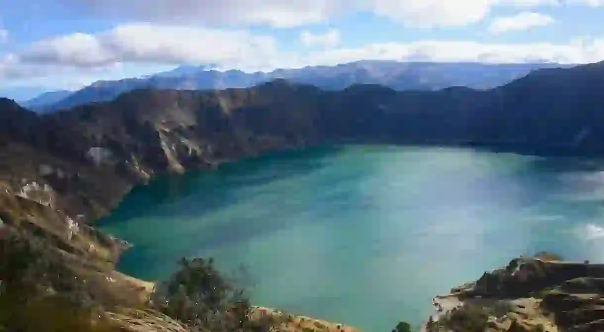
Quilotoa Lake fills the crater of the Quilotoa volcano, and is renowned for its ethereal, emerald green color. If you’re up for a challenge and are already acclimated to the high altitude, you can hike a four-day loop in the region around the volcano, passing through small towns such as Quilotoa, Chugchilán, Isinlivi and Sigchos along the way. You can also hike the trail around the crater itself, which you’ll have the opportunity to do on Culture Trip’s exclusive eight-day Ecuador adventure, led by our Local Insider. The shortest trail is to the Quilotoa Shalalá Overlook, which shouldn’t take more than an hour from the parking area at Quilotoa. The highest point of Quilotoa is 3,914 meters above sea level.
Cuicocha Lake

Translating as Guinea Pig Lake, the deep blue Cuicocha Lake was named as such because of the shape of the biggest island which supposedly resembles the furry creature. The crater was created after a huge eruption around 3,100 years ago. The hike around the lake is just under nine miles and can easily be completed in a day (or half-day). If you’d rather not walk that far, you can rent a kayak or take a boat trip to check out the island.
Cajas National Park
The national park is located in Cuenca in the Azuay province and is between 3,100 meters and 4,450 meters above sea level. Because of the enormous size of the national park (70,000 acres), you’re best planning ahead to decide which hikes you want to do, as they vary from a few hours to a few days. Alternatively, there are plenty of organised tours you can join – either for just a day or several days. There are eight marked trails of varying lengths and difficulty, passing through forests, páramo (grassy shrubland above the treeline, typical of South America), two of which start at the information center.
Tortuga Bay

Don’t worry if hiking at high altitude is not your thing. Tortuga Bay, on Santa Cruz Island in the Galápagos Islands, features a beautiful hike with a chance to spot endemic wildlife. The hike only takes about an hour starting from Puerto Ayora and the most eye-catching part of the route is when you reach Brava Beach. Here, you’ll see Marine Iguanas chilling in the shade. The best beach to swim along the way is Playa Mansa. It can get pretty hot, so remember to bring plenty of water with you.
Interested in visiting the Galápagos Islands? You can do so with Culture Trip on our overland express Galápagos adventure, led by our Local Insider.
Rucu Pichincha
Rucu Pichincha is a 4,784 metre-high volcano just outside Ecuador’s capital, Quito. For $8 you can take the cable car to the start of the hiking trail.Walking towards the summit of the volcano fromthe cable car will take you around three-four hours up and two-three hours coming back down. You can see lots of interesting birds along the way, such as the Curiquingue, which is the sacred bird of the Incas. It’s best to hike up Pichincha with a group, and unless you’re an experienced climber, with a local guide. Bring warm clothes and plenty of water.
Cotopaxi National Park
Cotopaxi Volcano is one of the highest active volcanoes in the world, reaching a height of 5,897 meters above sea level at the summit – Ecuador’s second-highest peak. It last erupted between 2015 and 2016, at which point it was temporarily closed for hiking. Hiking at this altitude requires plenty of preparation and is not recommended for people with vertigo or health issues. There are several other less extreme trails within the national park and also many good camping spots. If you want to experience being up close to an active volcano, you can hike up to the first shelter, which shouldn’t take more than one hour to reach.
Machalilla National Park
Machalilla National Park is located in the Manabí region of western Ecuador, and is one of the most extensively protected areas on the country’s Pacific coast, encompassing tropical dry forest, cloud forest, desert and coastal ecosystems. One of the main attractions of the park is the uninhabited Isla de La Plata, around 25 miles off the mainland, where you can see lots of Blue-Footed Boobies and Magnificent Frigatebirds. You can get there by joining a guided tour from Puerta Lopez. On the mainland, Playa Los Frailes, is one of the most beautiful beaches in Ecuador, characterised by pristine white sand, secluded rocky coves and warm, clear water.


