The Best Hiking Spots in Auckland

Walking in Auckland provides breathtaking views from Mount Eden, glorious beaches like Piha and intriguing islands such as Rangitoto. Here are the best hiking spots to check out in New Zealand’s biggest city.
Did you know – Culture Trip now does bookable, small-group trips? Pick from authentic, immersive Epic Trips, compact and action-packed Mini Trips and sparkling, expansive Sailing Trips.
Rangitoto Island summit track

Hop on a ferry from downtown Auckland and head to Rangitoto Island, the city’s highest and youngest volcanic cone. Hike through the world’s largest pohutukawa forest and lava field until you reach the summit, which stands 259m above sea level. You can enjoy views of the surrounding Hauraki Gulf and the Auckland city skyline. The Rangitoto Island summit track is 7km long return. Remember to pack a torch to explore the volcanic lava caves on a detour along the lava caves track.
Auckland’s coast-to-coast walk
Go on an urban hike across the city of Auckland from Waitematā to Manukau. This 16km hike goes through some of the city’s historic suburbs and includes a climb up some of the city’s volcanic cones, including the tallest natural point in the city, Mount Eden. The hike follows the route of ancient volcanic lava flows until its final point at Manukau Harbour. Visit the Auckland City Council website for a detailed map of this urban hike.
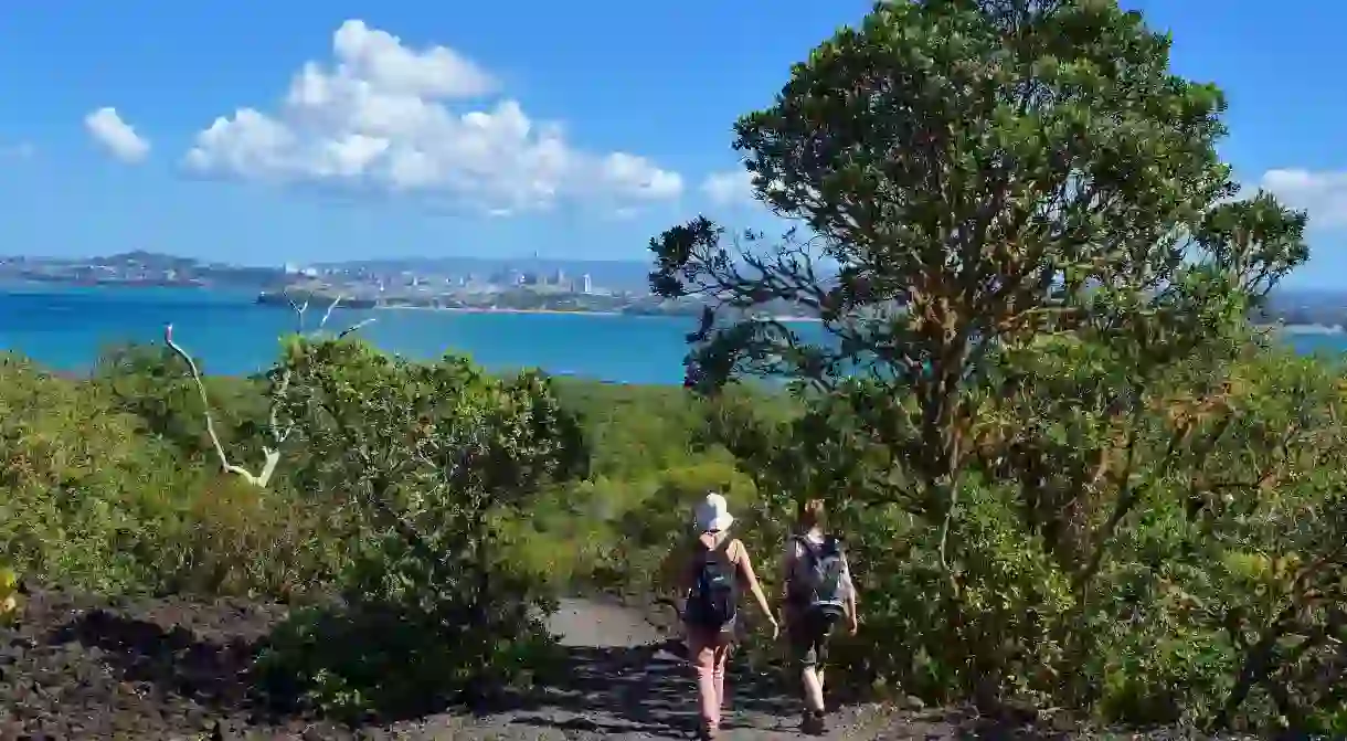
Shakespear Regional Park

Situated on Auckland’s North Shore in Te Haruhi Bay is Shakespear Regional Park, where you can hike through farmlands and native bush and enjoy views of the Hauraki Gulf. There are several short hikes to choose from. Hike along the 3.9km return Heritage Trail and pass a World War II gun placement site on your way, or head for the 4.8km Tiritiri Track, which passes an old Maori settlement area situated at the eastern end of the bay.
Mercer Bay loop path
Head to Auckland’s west coast and get the best views of the spectacular Piha beach on the Mercer Bay loop path. The 2.2km track starts high above Piha and continues to the Te Ahua headland with views up and down the west coast. This hike passes an ancient Maori settlement and includes interpretative signs about the historical significance of the area. Remember to wash the soles of your shoes at the cleaning sites to protect the local kauri trees in the Waitākere Ranges from dieback disease.
Rotoroa Island North Tower loop track
Hop on a ferry from downtown Auckland to Rotoroa Island, located about an hour’s boat ride from Auckland’s east coast in the Hauraki Gulf. The 82ha island is home to several hiking trails. Combine the North Tower and Southern Loop tracks to see as much of the island as possible. You could even pack a picnic lunch and swimming gear for a dip in Mai Mai Bay after your hike.


Tāwharanui Regional Park ecology trail

On Auckland’s north coast is Tāwharanui Regional Park, a coastal reserve home to seven hiking tracks that begin at Anchor Bay. The popular ecology trail takes about two hours along a stone beach before climbing through farmland and native forest. Pack swimming gear for a dip in the Pacific Ocean after your hike. The white-sand beach at Anchor Bay is also one of the best surfing and snorkelling spots near Auckland.
Read Next

The 5 Most Hipster Neighborhoods in Auckland, New Zealand

11 Fascinating Māori Myths and Legends

The Real Maori and Pacific Legends That Inspired Disney's Moana

The Coolest Neighbourhoods in Wellington, New Zealand

How To Spend Christmas in Queenstown, New Zealand

The Best Things to Do in Wellington at Night

The Most Beautiful Towns in New Zealand

The 9 Best Things to Do in New Zealand in Winter

How to Spend Christmas in Auckland, New Zealand

These Are the 10 Most Spectacular Glow Worm Caves in the World

The Coolest Neighbourhoods in Auckland, New Zealand

8 Maori Sayings You Need To Know Before You Travel
