A Traveller's Guide to The Milford Track, New Zealand

The Milford Track is one of the best known hiking routes in New Zealand. This four-day journey crosses the mountains and temperate rainforests of Fiordland National Park, enabling travellers to retrace the steps of the early explorers who ventured into the magical Milford Sound.
Before European settlers arrived on the South Island’s shores, the Indigenous Māori people would travel to Milford Sound via the Milford Track to fish, hunt and gather some precious greenstone jade, also known as pounamu.
After the first European settlers (re)discovered Milford Sound, word began to spread about its beauty; by the late 1890s-early 1900s the first hotel had been built to accommodate the growing number of visitors coming through the same walking route the natives had been using several years before them.

Fast forward to present times and the Milford Track has become known as one of New Zealand’s Great Walks: a status given to the highest-standard multi-day trails in the country. Others with that are part of this coveted list include the Tongariro Northern Circuit, the Heaphy Track and the Kepler Track, the latter of which also traverses Fiordland National Park.

As with all other Great Walks, the Milford Track has its on and off-seasons. Typically, the winter months (May-October) fall under the latter category as the route becomes more treacherous. You can still hike it during this time if you’re experienced enough to handle the winter hazards like slippery ice passages, avalanche-prone stretches and shorter daylight hours; but it’s also worth noting that in the off-season accommodation, heating and and toilet facilities become highly limited – and bedding is provided on a first-come, first-served basis.
Those tackling the walk during the high season definitely need to do some advance planning too. There are three huts on the Milford Track, but these need to be booked well in advance. It’s not uncommon for places to fill up as soon as the new season reservations are opened up to the public. Camping is not permitted around the Milford Track, so if you want to do the entire route, you do need to get your accommodation sorted out, pronto.

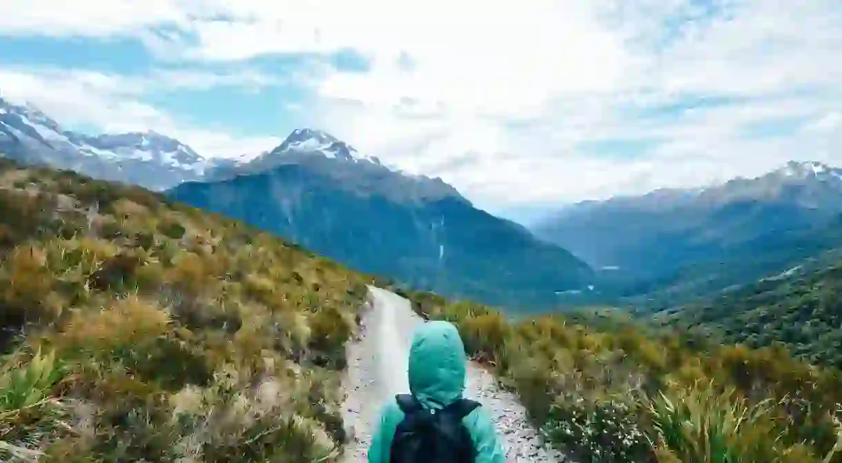
Now we’ve covered all the logistics, let’s take a closer look at the route you’ll be taking.


The Milford Track covers 53.5 kilometres (33.2 miles) and can only be walked in one direction. Your journey begins at Glade Wharf, which is located at the head of Lake Te Anau, and concludes by Sandfly Point in Milford Sound.
From Glade Wharf, you’ll cruise along the water of Te Anau Downs before you get to solid ground. From there, you’ll leisurely walk through the surrounding beech forests, along the banks of the Clinton River to finally arrive at the Clinton Hut – the first accommodation you’ll spend the night in. There’s no need to settle down right away: instead, spend some time exploring the wetland boardwalks and the swimming holes nestled around the hut. If you arrive on a late summer afternoon, a guided ranger might even take you on a guided tour of the area.

Day two sees trekkers departing the Clinton Hut and venturing towards the Mintaro Hut, a 16.5-kilometre (10.3-mile) trip that takes approximately six hours to complete. The trail starts with a gradual climb, contouring the Clinton River to reach its source (Lake Mintaro) at the base of the Mackinnon Pass. There are plenty of natural wonders to admire along the way, including the stunning Pomplona icefield, the towering rock walls that surround the Clinton Valley and the changing vegetation that comes into view as you climb into higher altitudes.

After spending the night at Mintaro Hut you’ll have your sights set on the awe-inspiring landscapes en route to the Dumpling Hut. This 14-kilometre (8.7-mile) trajectory comes with a trove of photo opportunities: a panoramic memorial site emerges as you climb to Mackinnon Pass, providing some great views of Lake Mintaro and Clinton Canyon. After you’ve spent some time admiring the vistas, you’ll make your way towards the highest point of the trek and the Mackinnon Pass Shelter. A steady drop through a lush alpine setting ensues, passing several waterfalls as you contour the banks of the Roaring Burn River before arriving at Quintin Shelter. A side trip just before the Dumpling Hut will enable you to admire the epic Sutherland Falls and Lake Quill from a faraway distance.

A five to six-hour, 18-kilometre (11.2-mile) trek from Dumpling Hut to Sandfly Point will finally bring this memorable journey to a close. This is also where you’ll gain some insight into the usage of the track throughout history.
First up, you’ll follow Arthur River to a historic boatshed; you’ll be able to spot several man-made rock carvings between Arthur River and Lake Ada, before reaching the powerful Mackay Falls and the ever-compelling Bell Rock. The final three kilometres (1.9 miles) of the trip consists of a smooth, wide track that was built by a prison labour gang in the early 1890s. From there, you just need take a short boat ride from Sandfly Point to Milford Sound – then it’s up to you whether you want to delve deeper into these remarkable horizons.

Read Next

The Best Things to Do in Wellington at Night

The Coolest Neighbourhoods in Auckland, New Zealand

The 9 Best Things to Do in New Zealand in Winter

The Most Beautiful Towns in New Zealand

How To Spend Christmas in Queenstown, New Zealand

8 Maori Sayings You Need To Know Before You Travel

11 Fascinating Māori Myths and Legends

The Coolest Neighbourhoods in Wellington, New Zealand

The 5 Most Hipster Neighborhoods in Auckland, New Zealand

These Are the 10 Most Spectacular Glow Worm Caves in the World

The Real Maori and Pacific Legends That Inspired Disney's Moana

7 Traditions Only New Zealanders Understand
