Photographic Sites in Death Valley National Park

Death Valley National Park covers 3.4 million acres of land between California and Nevada, making it the largest national park in the contiguous United States. It became a national park in 1994 with the re-designation by the California Desert Protection Act, expanding its size by 1.3 million acres. Its varied landscapes and geology attract photographers from around the world to come and experience its beauty. Here are the best photo spots at Death Valley National Park.
Zabriskie Point
Natural Feature

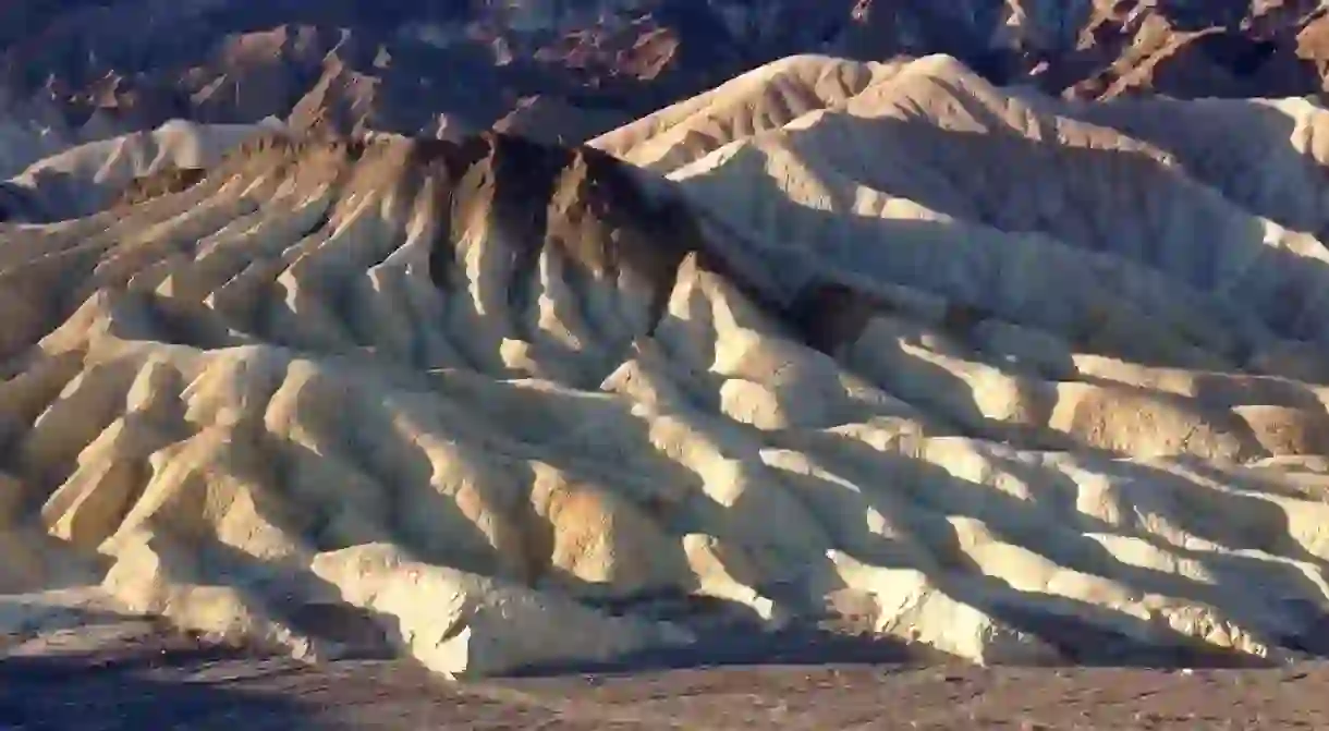
Located four miles southeast from Furnace Creek, Zabriskie Point is a popular location for taking sunrise photos. The colorful badlands were formed as saline mud and gravels were weathered by hot spring water. Get to the area an hour before sunrise to secure space and set up on the mound just below the viewing area. Bring a torch or a headlamp for navigation use. Sun rays start to hit the Amargosa Range and will keep on sweeping across until the Manly Beacon is lit.
Devil’s Golf Course
Natural Feature

Not to be mistaken with the actual golf course at Furnace Creek, Devil’s Golf Course is the result of a vast evaporation 2,000 years ago. The dirt and salt crystalline spires form a rugged terrain of over 200 square miles. The crystalline structures release popping sounds as the ground temperature rises. Devil’s Golf Course is located 15 miles from the Furnace Creek Visitor Center. The gravel road leading to Devil’s Golf Course is often closed after rain. Be sure to check road closure alerts before heading out.
Badwater Basin
Natural Feature

The basin was the site of a 30-foot deep lake 2,000-4,000 years ago. Water evaporated and left a layer of shimmering white salt. At 282 feet below sea level, Badwater Basin is the lowest point in North America. Located at 18 miles south of the Furnace Creek Visitor Center, Badwater Basin is a popular spot for day trippers and photographers. It is not easy to find perfectly shaped salt polygons due to the heavy foot traffic. Keep on walking out 8-10 miles and the polygons will be waiting to be captured. Beautiful magenta hues in the sky during sunrise or sunset are often reflected onto the pristine white salt flats.
Dante’s View
Natural Feature

This vantage point offers a breathtaking panoramic view of Badwater Basin, Devil’s Golf Course and Telescope Peak. Best time to visit this area is in the morning but nighttime offers spectacular star photography. Dante’s View was the filming location in Star Wars Episode IV.
Mesquite Flat Sand Dunes
Natural Feature

Located near Stovepipe Wells Village, the Mesquite Flat Sand Dunes are surrounded by mountains. The primary source of sand is the Cottonwood Mountains. The sand dunes display spectacular golden glow at sunset but the pristine contours at sunrise is also worth the effort. Arrive an hour before sunrise or sunset and wait for the light to do its magic. This was another filming location in Star Wars Episode IV where R2D2 parted with C3P0 after they crashed their escape pod.
Racetrack Playa
Natural Feature

This dry lake bed is home to the famed traveling boulders. Paths created by these sliding rocks have been extensively studied though the cause is still largely unknown. There is no vegetation on the playa. Camping is not allowed. Access requires high clearance vehicles with heavy duty tires. This amazing sight is located 27 miles from the Ubehebe Crater on an unpacked gravel road.
If these stunning sights have convinced you to visit this extraordinary place, why not book a stay at one of these excellent Death Valley hotels?


