Step Back 50 Million Years in Time on the Beautiful Basque Coastline

It’s only a matter of time before outdoor enthusiasts from around the globe begin to discover the stunning Basque coastline in Northern Spain. If you are looking for a hiking adventure for beginner or experienced hikers, with awe-inspiring rock formations, dramatic cliffs and stunning verdant scenery, then a visit to the 50 million-year-old Flysch is a must.

Just a one-hour drive from Bilbao Airport is Zumaia. Together with its neighbouring town of Deba, the two locales form the incredible Basque Coast Geopark. This Geopark boasts both unique and natural rock formations known as Flysch.
What is flysch?
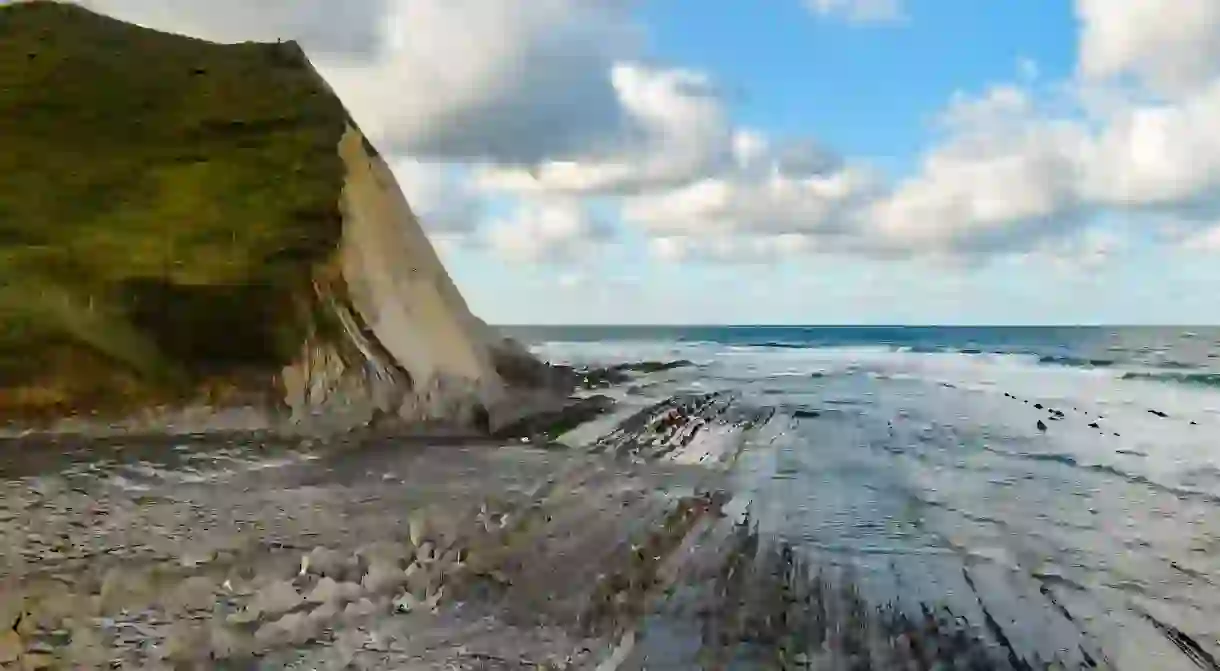
Flysch formations are sedimentary structures in which hard layers of limestone and sandstone alternate with soft layers of clay and rock. It’s not easy to describe the unusual appearance of Flysch. In some places, it resembles stacked pages of a book, and in others parts, it looks like rows of sharks’ teeth.
This area of the Basque Coast is declared as a protected Biotope due to its geological significance. The collision between European tectonic plates exposed the Flysch sediments over 50 million years ago and, remarkably, it can still be seen today. The landscape feels almost surreal at times, and it’s no wonder Game of Thrones decided to film here for their latest series.

The hiking highlights
One of the best ways to see the fabulous formations is to hike the stunning trail from Zumaia to Deba. This 15-kilometer hike starts along the GR121, from the chapel of San Telmo on the Zumaia Ridge. Heading away from the jagged coastline and crashing waves, the path moves inland toward the Basque countryside; within a few minutes, the wonderful rock formations appear. The atmosphere and surroundings begin to change. Picture-postcard mountain farms with fields of sheep and ponies become the new landscape, followed by a build-up of pine trees before approaching a picnic area (Elorriaga), which is roughly the halfway point.
Part of this hike overlaps the Santiago de Compostela path (marked in yellow) which may add prestige or spirituality for those who walk along this famous pilgrimage route. Once leaving Elorriaga, this hike really starts to unfold. The lookout at Arantzako Portua yields wide-angle views of the Basque coastline. Just a stone’s throw away are the imposing cliffs of Sakoneta and Mendatagaina.
Perhaps the big highlight can be found at Sakoneta point. This is the opportunity to get up close and personal to the Flysch. It’s not necessary to be a geologist to appreciate the phenomenal rock beds. However, remember that it’s only possible to drop down to sea level at the Sakonetain low tide, so make sure you go at the right time of day to truly explore.


Ending with a treat
Toward the end of the hike, the path becomes quite steep near the Santa Catalina sanctuary, a small and picturesque abandoned chapel. In the distance, the coastal town of Deba signifies that the finishing line is in sight. After a day of hard but incredibly rewarding hiking, why not celebrate with some of the Basque region’s delightful and diverse cuisine? Thick hot chocolate and churros provide the ultimate post-hike indulgence.

About the author

Hello! I am themanwhohikedtheworld. The Londoner who travels the globe in search of great walking routes I want to give hiking ideas and outdoor inspiration to adventurist souls, in an accessible way. I love to stimulate peoples curiosities and therefore my social media pages cater for those who are looking something different.
Read Next

The 29 Most Beautiful Towns and Cities to Visit in Southern Spain

Must-Visit Attractions in Asturias, Spain

The Most Beautiful Medieval Villages In Catalunya, Spain

The Top 10 Things to See and Do in Jerez de la Frontera, Spain

The Coolest Neighbourhoods in Cordoba

The 10 Most Beautiful Spots In Basque Country

A Neighborhood Guide to L’Eixample: Barcelona

Best Markets In Madrid You Should Visit

Top Things to Do With Kids in Bilbao

The Most Unique Experiences To Have in Madrid

10 Traditional Spanish Dances You Should Know About

Top 10 Things to See and Do in Vigo
