WINTER SALE: Save up to $862 on our trips! Book now and secure your adventure!

The 6 Best Day-Trips From Batumi
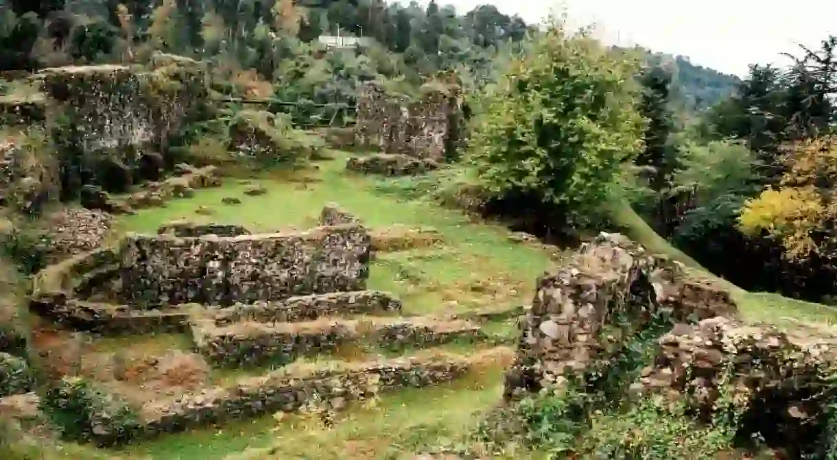
Petra Fortress in Tsikhsidziri
Petra Fortress in Tsikhsidziri | © Rusudan Beridze / WikiCommons

The coastal city Batumi is the second-largest city in Georgia. Located in the subtropical zone near the Lesser Caucasian Mountains, Batumi is a popular destination for locals and visitors. During summer months, Batumi is a bustling resort, while in winter it is covered in snow. Also an important seaport, Batumi offers many exciting landmarks for you to explore. Once you finish touring around its centers, pick one or two or three of these amazing sites just outside of Batumi and go on a day-trip.

Fortresses of Gonio and Petra

Gonio Fortress, located just an hour drive from Batumi, is a Roman fortification from the second century AD; the area was a well-fortified Roman city in the Colchis Kingdom. It is believed that the grave of one of the twelve apostles, Saint Matthias, is here. Unfortunately, this claim is unverified because the Georgian government won’t allow digging near the presumed grave-site. Other archaeological excavations have been focused on the layers of the Roman fortress.

Gonio Fortress

Gonio Fortress

Petra used to be a fortified town on the coast of the Black Sea in the ancient Colchis Kingdom. During the reign of Byzantine Emperor Justinian I (sixth century), the area became an essential Eastern Roman position in the Caucasus. Moreover, because of its strategic locations, from 541 to 563 AD, it became a battlefield for the Lazic War between Rome and Persia.

Petra Fortress

Scholars identify Petra as a ruined settlement of Late Antiquity containing a 656-foot-long (200 m) citadel, baths, urban settlements, water cisterns, and more. Scholars believe that the citadel had a sizable three-nave basilica with a grand narthex and apse (entrance and aisles) that date back to the sixth century. The fortress is located in the village of Tsikhisdziri, a 40-minute ride from Batumi.

Petra Fortress

Mtirala National Park

Building, Park

Mtirala_national_park
© MIKHEIL / WikiCommons``
Located just 17 miles (28 km) away from the city, Mtirala National Park covers 38,790 acres (15,698 hectares) of land between the Black Sea and the Adjara Mountains. You can explore sweet chestnut and oriental beech wood forests, and hike up the two trails to experience Georgia’s breathtaking landscapes.Mtirala in Georgian means “crying.” The area got its name from the 178 inches (4,520 mm) of rainfall the park gets annually, making it the wettest area in post-Soviet countries.
Tsablnari (Chestnut Forest) trail is a 4.3 mile (7km) trek that rises from 869 feet (265 m) above sea level to 1,450 feet (442 m). The trail leads to the waterfall and the lake. The waterfall is covered with Colchic box trees and ivy. And if you happen to like the area, you can camp here or even have a picnic near the designated fire pits.
There’s another two-day trail in the park that takes you 4,101 ft (1,250 m) above sea level. This trail is great for exploring flora, watching roe deer, and running across signs of brown bear, martens, and chamois (goat-antelope). There’s a shelter on the trail that has picnic spots, restrooms, fire pits, and room to accommodate eight hikers overnight.

Kintrishi Protected Areas

Bridge, Church, Forest, Park

Adjoining Mtirala National Park is the Kintrishi Protected Areas, located in Kobuleti District at the gorge of the Kintrishi River. Established in 1959, the area preserves unique flora and fauna, including the famous Colchian willow trees. Covering 46,686 acres (18,893 hectares), the park has many secrets and surprises. Recent archaeological expeditions even revealed pre-Christian monuments in this area. The area offers a trail that can be quickly hiked in a day called Tamara Arch Bridge and Box-Tree Stand. The track starts at an arched stone bridge, an eleventh or twelfth century architectural masterpiece that crosses the Kintrishi river. The trail continues through the forest toward the St. George Church and ends at an enchanting forest that is more than 300 years old. The forest is full of box-trees as high as 40 ft (12 m).

Martvili Canyon

Natural Feature, Park

Martvili_20
©Paata vardanashvili / WikiCommons
Martvili Canyon is one of the country’s most gorgeous nature spots. Take a walk in the beautiful scenery, ride a boat on the emerald-green Abasha river, and hike up to the waterfalls. The drive to Martvili takes about three hours, and you’ll need half of the day to spend in the park itself. The trail is .4 miles (700 m) long and features two bridges, several viewpoints, and a 30-step staircase formed from large limestone boulders.

Green Lake (Mtsvane Tba)

Green Lake (Mtsvane Tba)
The drive toward Green Lake takes about three hours, but the trip is worth it. Situated in the charming Goderdzi Pass, the lake is 6,752 ft (2,058 m) above sea level and has a natural green color. Relax and take astonishing pictures of the landscape. In warmer months, you can swim in the lake’s green waters.

Machakhela National Park

Bridge, Museum, Park

Another very short drive from Batumi takes you to Machackhela National Park, where you can see one of the oldest and most breathtaking parts of the Adjara region: Machakhela Gorge. Here, you can explore Gvara Fortress, discover waterfalls, visit the village of Ajarisaghmarti, and cross the lovely Tskhemlara arched bridge. You can also visit the Machakhela Ethnographic Museum for a fun history lesson.

About the author

I am a travel blogger, content writer, food lover and a passionate photographer. Four years ago I quit my editorial job at the newspaper in order to pursue my passion of traveling through South East Asia. Check out my adventures at redfedoradiary.com or follow my daily rambling on Instagram @redfedoradiary.

If you click on a link in this story, we may earn affiliate revenue. All recommendations have been independently sourced by Culture Trip.
close-ad