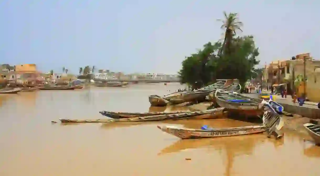
Senegal’s Historic City Disappearing Under the Waves

Saint-Louis, the former capital of Senegal, is facing an existential threat – commonly known as the ‘Venice of Africa’, this city located near the Senegal River and the Atlantic Ocean is now at the mercy of coastal erosion and rising sea levels. Is Senegal’s historic city really disappearing under the waves?

A historic past, a worrying future
Saint-Louis is not your archetypal African city. Built on a sandbank on the Senegal River Estuary, the colourful colonial architecture and fleet of motorised pirogues (canoes) gives the island a distinctive character.
Granted UNESCO World Heritage status in 2000, the city of around 230,000 was founded by the French in 1659. Its strategic position on the mouth of the Senegal River, with easy access to the Atlantic, saw Saint-Louis become a major trading hub for the export of leather, gum, gold and slaves. It would serve as Senegal’s capital until 1957 and even briefly (1895-1902) as capital of all of French West Africa.
However, its unique locale could now be its downfall, with a swelling river and advancing sea threatening to pull the sandy rug from beneath its feet.

What is happening?
According to the UN’s Habitat Agency in 2008, Saint-Louis is “the city most threatened by rising sea levels in the whole of Africa” with a combination of climate change and a disastrous anti-flood measure the principal perpetrators.
The latter came in 2003. With its low-lying position on an estuary, the island city had long been vulnerable to flooding during the seasonal rains. In 2003, fearing particularly heavy floods, a decision was taken to build an emergency channel straight from the river to the Atlantic ocean through a narrow spit of land called the Langue de Barbarie (Barbary Tongue). Home to around 80,000 people, the Langue is between 200 and 400 metres (565 and 1,312 feet) wide and acts as a natural buffer between the two mighty bodies of water. It’s now disappearing into the sea.
The 4 metre (13 feet)-wide emergency channel opened the door for the voracious Atlantic. Invaded by the ocean waters, the channel has grown to 6km (3.73 miles) in width, submerging anything in its path, be it nesting sites or fishermen’s homes. In just 15 years, some 200 families have been displaced, while the salt water has played havoc with the delicate eco-balance in the estuary.
Rising sea levels and the ever-widening breach has allowed the once-protected Saint-Louis to feel the wrath of the Atlantic. The wrought-iron balconies of its iconic buildings starting to crumble into the silt.

What stands to be lost?
On the Langue de Barbarie, trees emerge directly from the waves. Breeze block buildings sink into the wet sand. The Atlantic is destroying habitats and homes, but also livelihoods.
The majority of those on the peninsula are fishing communities who rely on the ocean to survive. Despite the Atlantic claiming their homes, inhabitants have been reluctant to leave, instead squeezing up into ever more densely-populated villages on the peninsula. Moving inland makes it harder and more expensive to get to the sea, as well as less profitable; the whispers of big catches and huge shoals don’t make it out to the temporary camps.
The village of Done Baba Dieye, situated about a 10-minute ride in a motorised pirogue from the Senegal River mouth, was the first to be abandoned in 2012. Some 10 miles (16 km) south of Saint-Louis, two others have followed suit. Saint-Louis – with some of the best examples of French colonial architecture in west Africa – is staring down the barrel of a similar fate.

What conservation efforts are in place?
Since the disaster of 2003, conservation efforts have been less gung-ho, while there has also been a common consensus that the waves cannot be stopped. The state is currently paying for a French company to build an embankment on the Langue to protect it, and Saint-Louis, from a watery grave, but it is merely a temporary fix until a long-term solution has been found. President Macky Sall has suggested building a 3.5 km (2.18 mile)-long sea wall, others a breakwater, some want to re-sand the beaches, others think it best to clear them and create a new ‘buffer zone’.
While there may be no consensus on the plan, there is reason to hope, especially with the international community pledging funds. The World Bank has already promised $24 million to slow the ocean’s advance, as well as $30 million to relocate 900 of the most vulnerable families (around 10,000 people) in the coming years. French President Emmanuel Macron has earmarked $18 million to fight coastal erosion and a further $31 million to renovate local landmarks and architecture.

Africa paying for the world’s mistakes
Coastal erosion is being keenly felt Saint-Louis, but it is not alone. The river deltas of Sine-Saloum and Casamance in the south of Senegal have seen rising sea levels take over their islands. The beach resort of Saly has had to install breakwater defences to quench the ocean’s thirst for land. Coastal erosion is reclaiming between one and two metres (3.3 and 6.6 feet) of land each year up and down the coast. Africa may have contributed very little to the world’s carbon dioxide emissions, but it is paying a heavy price.


