Zealandia: Everything You Need to Know About Earth's Eighth Continent

Zealandia is the closest thing the world has to a real-life Atlantis. You can only see its tip on the surface, but deep within its oceans lies a much bigger mystery. The submerged continent, which sits in the South Pacific, and is believed to have separated from Australia more than 60 million years ago, might just have a few secrets to share about the Earth’s formation.
Getting one’s bearings
The micro-continent of Zealandia sits east of Australia and has a land mass of approximately 4.9 million square kilometres (around 3 million square miles). Only seven percent of it is above sea level, the two largest parts being New Zealand and New Caledonia.
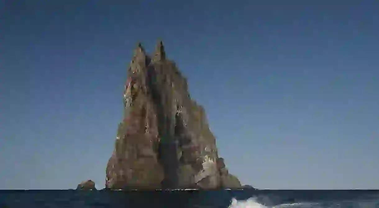
Balls Pyramid, a remnant of an eroded volcano which formed some 6.4 million years ago, is another point in which Zealandia rises above sea level. It is part of Lord Howe Island Marine Park in Australia and, with a height of 551 metres (1,807 feet), it is believed to be the highest volcanic stack of its kind in the world.

Zealandia, unearthed
Recently, a team of 32 scientists, from 12 different countries, embarked on a two-month expedition to study the lost continent. Their ship, the JOIDES Resolution, arrived back into Hobart, Australia, in September 2017, bringing new knowledge about this curious landmass and the geological treasures it hides.
Led by co-chief scientists Gerald Dickens of Rice University in the U.S. and Rupert Sutherland from New Zealand’s Victoria University of Wellington, the team drilled deep into the seabed to collect 2,500 meters (8,202 feet) of sediment samples across six different areas with a depth of more than 1,250 meters (4,101 feet). The idea was to study these specimens in order to identify how the continent’s geography, climate and volcanic activity has changed over the last 70 million years.

Dickens told the National Science Foundation that the excavation unveiled hundreds of fossil species, ultimately proving there was once life in the buried continent:
‘The discovery of microscopic shells of organisms that lived in warm shallow seas, and of spores and pollen from land plants, reveal that the geography and climate of Zealandia were dramatically different in the past.’
Sutherland also added that this new discovery could be instrumental in understanding the geological makeup of the wider Pacific region.
‘Big geographic changes across northern Zealandia, which is about the same size as India, have implications for understanding questions such as how plants and animals dispersed and evolved in the South Pacific.’

Why the interest in it now?
Zealandia’s existence was known to scientists from as early as 1919, when the landmass was dubbed the Tasmantis Complex. It wasn’t until much later, in 1995, that geophysicist Bruce Luyendyk coined ‘Zealandia’ as the collective nomenclature for New Zealand, the Chatham Rise, the Campbell Plateau and the Lord Howe Rise.
Zealandia’s discovery and re-discovery is the result of gradual, on-going scientific analysis. In the 1990s Zealandia was thought to consist of three out of the four main features to qualify for ‘continent’ status. The general consensus is that continents need to have a high elevation in relation to oceanic crust, a large range of rock formations, a thicker crust and lower seismic structure than other oceanic land masses and well-defined territorial boundaries. It was the latter which scientists took longer to discover and what ultimately earned Zealandia its place as the Earth’s eighth continent in 2017.
New Zealand geologists Nick Mortimer and Hamish Campbell spearheaded the case for making Zealandia a continent in 2014, with the release of a book titled Zealandia: Our Continent Revealed. Later, with a team of nine other geologists from New Zealand, Australia and New Caledonia, Mortimer and Campbell were able to solidify their claims. With the aid of satellite technology, they conducted six-year study that revealed Zealandia is, in fact, a largely unified area.

Whether Zealandia will be fully recognised as a continent in its own accord will be largely dependent on history. Currently, there’s no scientific body in charge of making a formal decision, unlike the protocols for, as example, classifying planets (Pluto being the best known example) or procedures like naming a mountain. Its recognition will depend on its ability to make its presence in the world stand out, from its addition to world maps to references in popular culture at large.
In fact, the discovery itself is crucial not just for learning about the breaking up of Gondwana and the Earth’s geological evolution but also because it can have significant impacts on geopolitical relations. The submerged part of Zealandia holds many mineral deposits, fossil fuels and natural gas fields. Because most of it falls under New Zealand’s Exclusive Economic Zone, the nation currently controls the area’s undersea mining activity and natural resources.
As new information comes in, it may well be that conversation shifts to who deserves a piece of Zealandia’s riches. New Caledonia and surrounding islands comprise approximately seven percent of the continent, and the rest consists of a handful of Australian territories, including Norfolk Island as well as Elizabeth and Middleton Reefs.


